


Original World War 1 Map dated July 27th, 1916
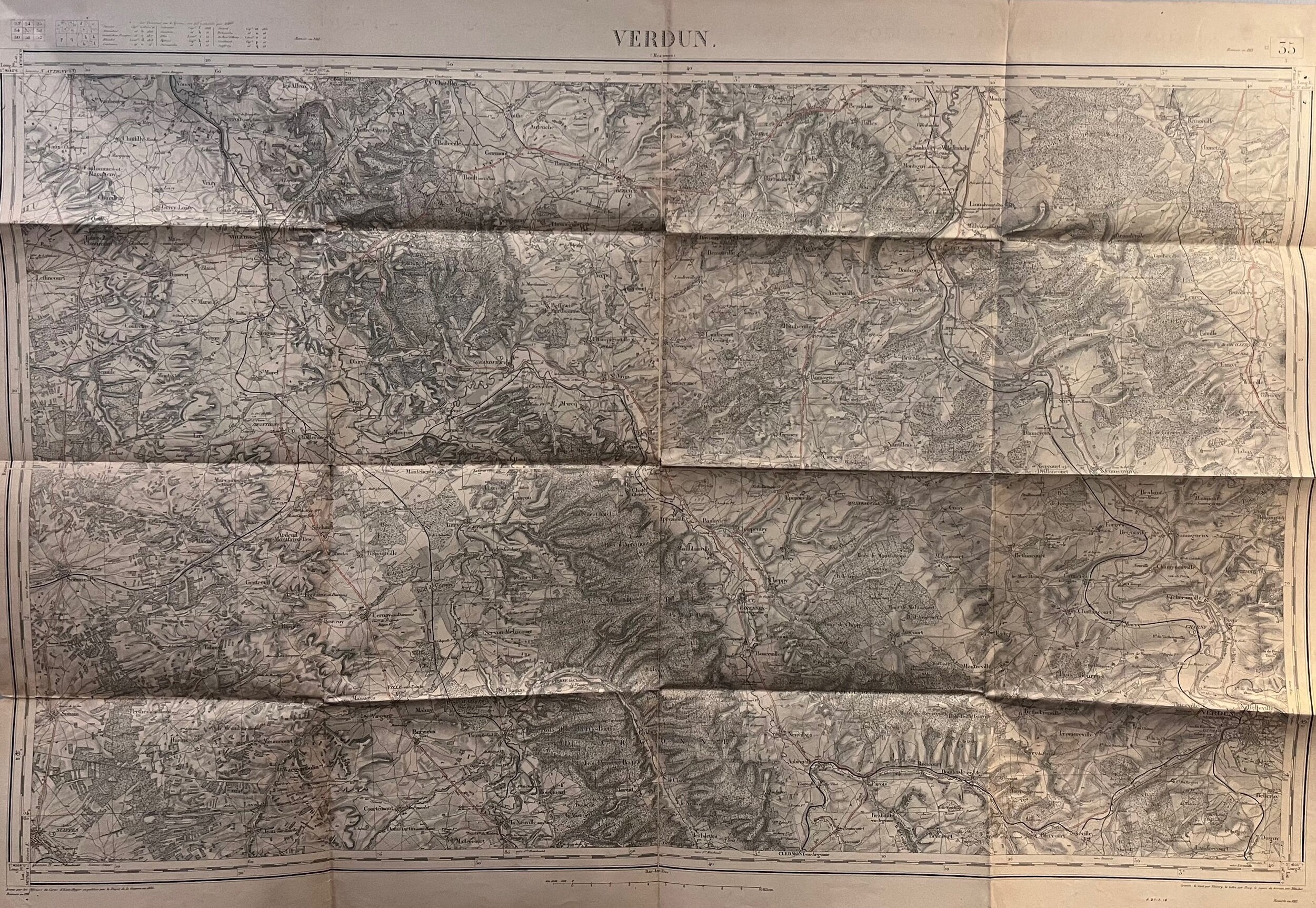
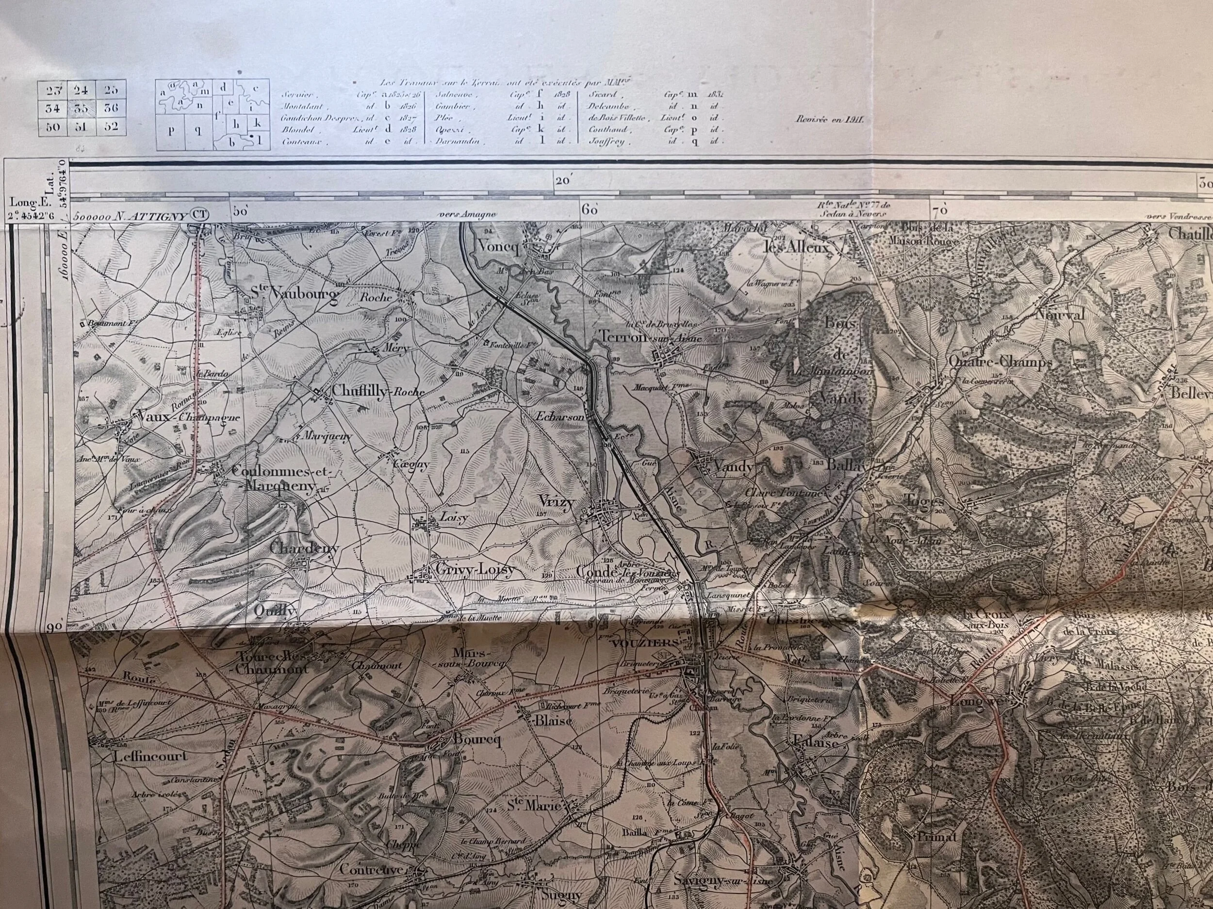
This World War 1 French operations map was printed and revised in 1913 with an additional revision (R. 27-7-16) of July 27th, 1916. Which happened to take place right in the heat of the Battle of Verdun. This map shows geographical and topographical landscape of Verdun and the surrounding land that would be fought over. This map has pin holes at the top that more than likely shows that it was hung up at one point or another, maybe during the battle but you cannot tell. Has creasing from where it was folded and stored for a period of time. The integrity of the paper is still very impressive and all in all in great shape. This would make a great display on someone’s wall. This piece measures 33.5” by 23.5”.
This World War 1 French operations map was printed and revised in 1913 with an additional revision (R. 27-7-16) of July 27th, 1916. Which happened to take place right in the heat of the Battle of Verdun. This map shows geographical and topographical landscape of Verdun and the surrounding land that would be fought over. This map has pin holes at the top that more than likely shows that it was hung up at one point or another, maybe during the battle but you cannot tell. Has creasing from where it was folded and stored for a period of time. The integrity of the paper is still very impressive and all in all in great shape. This would make a great display on someone’s wall. This piece measures 33.5” by 23.5”.